The strongest hurricane ever recorded in the Americas is bearing down on Mexico's Pacific coast, threatening a "potentially catastrophic" landfall.
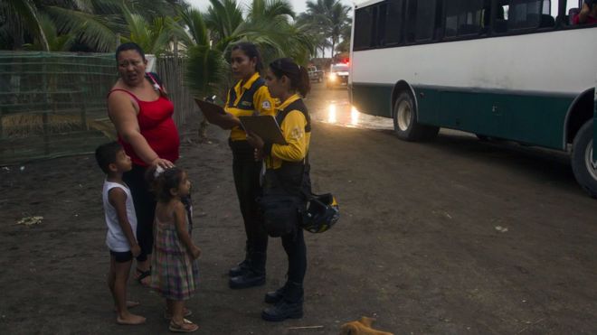
Mexican authorities have begun evacuating residents ahead of the arrival of Hurricane Patricia.
The storm is comparable to Typhoon Haiyan, which killed 6,300 people in the Philippines in 2013, the World Meteorological Organization says.
A state of emergency has been declared in three states in Patricia's path.
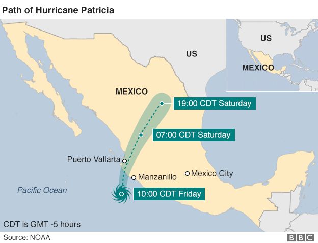
The category five hurricane is expected to make landfall on Friday afternoon or evening, with winds of 325km/h (200mph).
The US National Hurricane Center said on its website: "Potentially catastrophic Hurricane Patricia moving northward toward landfall in south-western Mexico."
The centre added that it was the strongest storm it had recorded in the eastern Pacific or the Atlantic.
Some 400,000 people live in vulnerable areas, according to Mexico's National Disaster Fund.
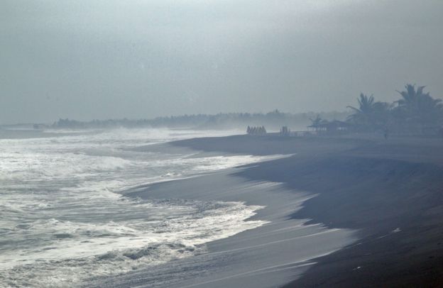
The hurricane, which will bring torrential rain, could trigger flash floods and mudslides, the US centre said.
It also warned of potential flooding from the sea and destructive waves.
The hurricane's winds are strong enough "to get a plane in the air and keep it flying", World Meteorological Organization spokeswoman Claire Nullis said. Earth explains: What is a hurricane?
According to forecasters, Patricia will make landfall in the western state of Jalisco, home to the resort town of Puerto Vallarta, which could lie directly in its path.
Police patrols in the resort urged people to leave the shorefront for safer areas at least three blocks inland, while loudspeakers ordered hotel residents to evacuate.
Few people were seen going to official shelters, designed to accommodate 259,000 people, though there were queues at the local bus station.
The town's airport, along with two others in the path of the storm, were closed.
Schools have been closed in Jalisco, Colima and Guerrero states.
 AFP
AFP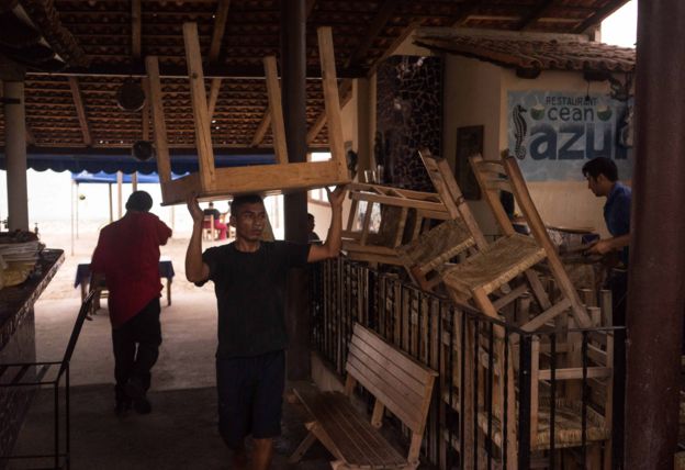 AP
AP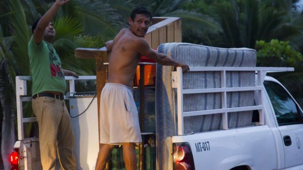 AFP
AFP
Shop owners in Manzanillo, a major port in neighbouring Colima state, have begun boarding up windows.
"[It's] better to be safe than sorry. Hurricanes are unpredictable," furniture store manager Enrique Esparza told AFP news agency.
Residents have also begun stocking up on food and other supplies.
Heavy rains often lead to flooding in the town, said Alejandra Rodriguez, who was shopping at Wal-Mart in Manzanillo with her brother and mother.
"It ends up like an island," she said.
Some rural areas are prone to landslides and flooding. The government has warned that ash from the nearby Colima volcano, which has become increasingly active this year, could combine with heavy rainfall to trigger huge mudflows.
Mexico has to deal with tropical storms arriving from both the Pacific and Atlantic oceans at this time of year.
Some of the most powerful storms in recent years
- October 1979: Typhoon Tip - largest and most intense tropical cyclone ever recorded with wind speeds of 305km/h (190mph), killed 99 people in its path across the Pacific, mostly in Japan
- August 1980: Hurricane Allen - strongest Atlantic hurricane by wind speed, with sustained winds of 305km/h, caused nearly 300 deaths in Haiti and severe damage in the US state of Texas
- April 1991: Bangladesh cyclone known as 02B - at least 138,000 died and up to 10 million made homeless after a 6m storm surge
- October 1991: Odisha or Paradip cyclone - the strongest ever recorded in the northern Indian Ocean, killed about 10,000 people, mostly in India
- August 2005: Hurricane Katrina - killed at least 1,836 people after striking US states of Louisiana and Mississippi and was the costliest storm in history, causing $81.2bn in damage (with wind speeds of 280km/h)
- October 2005: Hurricane Wilma - most intense tropical cyclone in the Atlantic basin with wind speeds of 295km/h, killing 87 people on its path through the Caribbean and Gulf of Mexico
- November 2013: Typhoon Haiyan - the strongest storm recorded at landfall, with one-minute sustained wind speeds of 315km/h, it devastated parts of the Philippines, killing at least 6,300 people
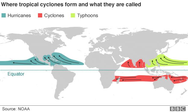
Hurricanes, typhoons and cyclones are all part of the same weather phenomenon but different names are used depending on where the storms are formed. Hurricanes form east of the International Date Line, while typhoons and cyclones form to the west.
stay update and connected with gossipbank.com
 Stay Updated And Connected With sofogist.Com Daily..


